


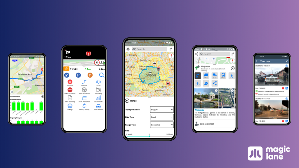
Magic Lane unveils new Android version of its Magic Earth navigation app
Amsterdam and Brașov, May 2nd Magic Lane, a leading provider of innovative Maps, Location & Navigation solutions, has unveiled a…
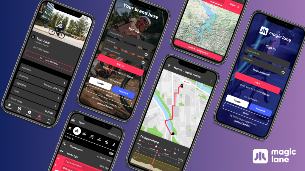
Magic Lane launches a branded concept Companion App to boost innovation in the micro mobility and (e-)bike industry.
Amsterdam, the Netherlands – March 23, 2023 It is no secret that the micro mobility and E-bike industry is a…
New name, new branding, new focus... same product
New name, new branding, new focus… same product Magic Lane, an intelligent Maps, Location & Navigation platform for developers in…

Magic Lane launches new AI Dashcam 2.0 model in the AI Store™
Magic Lane AI Dashcam ADAS 2.0 is now available in the AI Store™ LAS VEGAS, NV — November 9, 2021…


